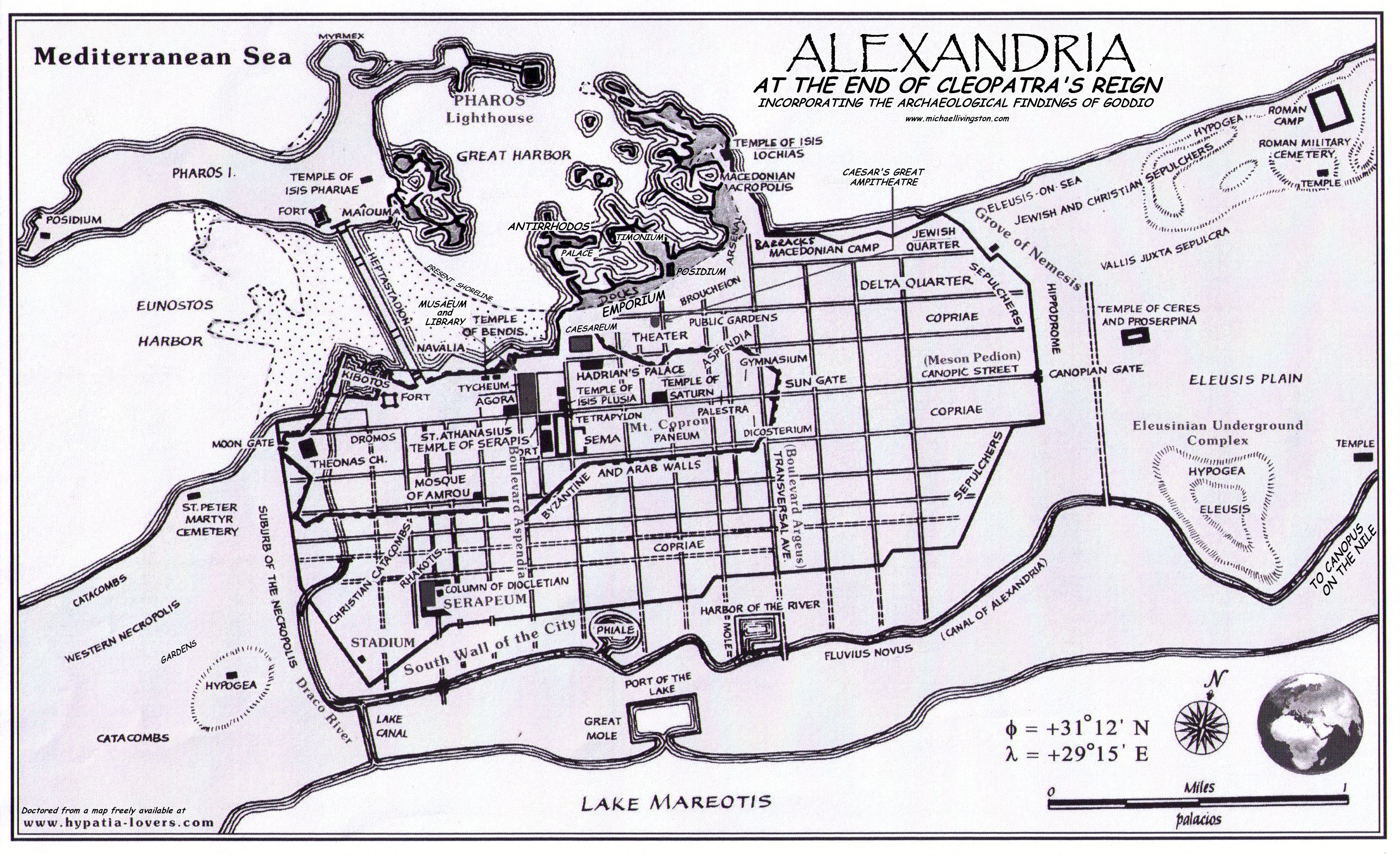
In my research yesterday, I found a really spiffy map of ancient Alexandria — spiffy, that is, except for being wildly inaccurate about the all-important Great Harbor. This isn’t the mapmaker’s fault. Alexandria’s coastline is radically different now as a result of seismic activity, erosion, and human manipulation. Antirrhodos, for example, the private royal island where Cleopatra’s palace was built, is now underwater. So until recently we could only guess at the ancient topography.
Fortunately, the past decade has seen a wealth of new data about the harbor area in particular, largely due to the underwater archaeological work of Franck Goddio. We now have a much better idea about what things looked like in Cleopatra’s time.
So I did some doctorin’ of the old map I found: transposing the Posidium/Timonium Peninsula with Antirrhodos, greatly altering the Lochian Peninsula, moving the current and former coastlines, changing the location of the Great Lighthouse of Pharos, and a host of other little things here and there. It’s a big file, but those interested in this revised map can find it here:
The Map of Cleopatra’s Alexandria (2.7 Mb)
Even this map still isn’t perfect for my purposes — if I were making it from scratch I’d open up a bigger area for the Paneum in the center of town, erase the post-Ptolemaic references, and better represent the structures in the city — but it’ll do until I finish the book.
Nice! Having seen the original, I can say that you’ve done a great job fixing it up. It’s amazing to me that they found so much underwater after all this time. Wow.
heyyy wats up
is that a pic of king tut up there?!!!??!!?!
Ah, Ms. Duff. Good to hear from you. How’s the career?
So much for the underwater archaeological work. Congratulations for the job well done!
Shangri